-
title Cape Kanezaki one word explanation outcrop of lapilli tuff keywords geologynaturebeautiful confirm, register Oga Quasi-National Park conservation laws and ordinances Natural Parks Act 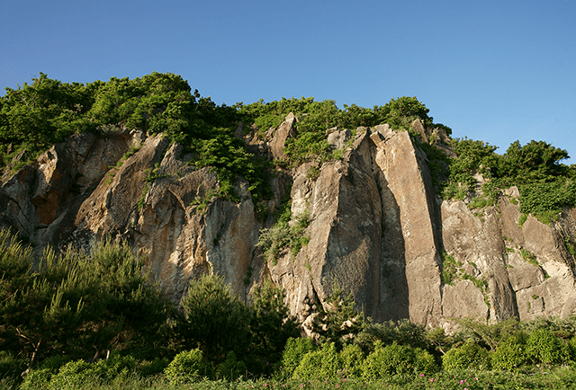
On the western side is Cape Tateyamazaki, while this eastern cape is called Cape Kanezaki. The cliffs of Cape Kanezaki are about 35m tall and the exposed face is a volcanic rock called lapilli tuff. Formed about 21 million years ago at the same time as Cape Tateyamazaki, Cape Kaneyamazaki has been eroded over the years by violent waves into what is known as a sea cliff. Here you can see the glossy surface called slickenside, which is formed when the hard rock is dislodged.
-
title Northernmost Natural Habitat of Camellia Japonica one word explanation Now a place name, Oga City’s flower, Camellia japonica keywords naturelegendbeautiful confirm, register National Natural Monuments, Oga Quasi-National Park conservation laws and ordinances Act on Protection of Cultural Properties、Natural Parks Act 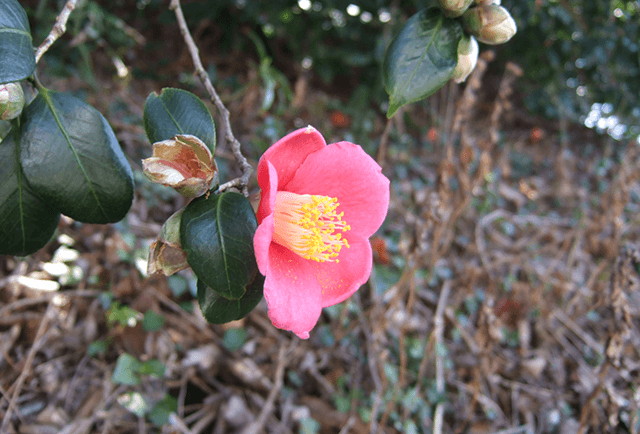
Designated a national natural monument along with Aomori Prefecture’s Natsudomari Peninsula, this is the northernmost region of Japan where wild camellias grow. They grow mostly around the Mt. Notoyama area, where 308 camellia plants have been confirmed according to a 2010-2011 survey. From a sad legend of two young lovers which tells how camellias came to grow on Mt. Notoyama, to the many local place names with “tsubaki” (the Japanese word for “camellia”) in them, Oga City has a deep connection with camellias and they are an important cultural artifact protected by local residents.
-
title Tsubaki no Shiraiwa Rocks one word explanation A record also left by Sugae Masumi, also known as the Maitake Rocks keywords geologyhistorynature confirm, register Oga Quasi-National Park, One hundred strange sotones from Japan conservation laws and ordinances Natural Parks Act 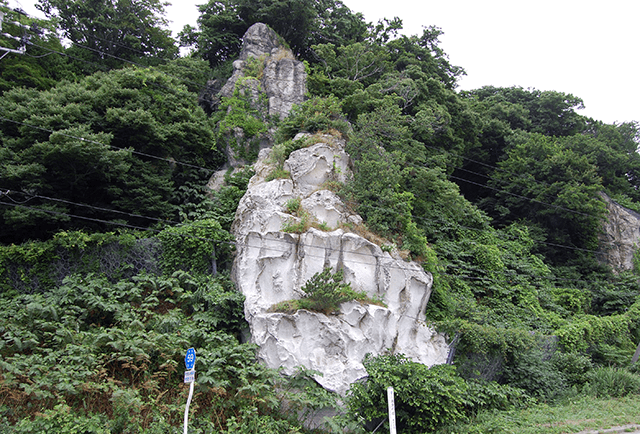
The Edo Period travel writer Masumi Sugae wrote of Tsubaki no Shiraiwa Rocks: “Shaped like maitake mushrooms, they appear blue when wet with rain or sea water.” Though they look as if they were scooped out by an ice cream spoon, in reality they reached their present shape through many years of weathering. They are a type of volcanic rock called lapilli tuff formed by volcanic activity about 21 million years ago. A large-scale version of these white rocks can be seen on the Sugoroku Fishing Port side.
-
title Green Tuff one word explanation the beautiful green hue is a distinguishing characteristic keywords geologybeautifulsearch confirm, register Oga Quasi-National Park, One hundred strange sotones from Japan conservation laws and ordinances Natural Parks Act 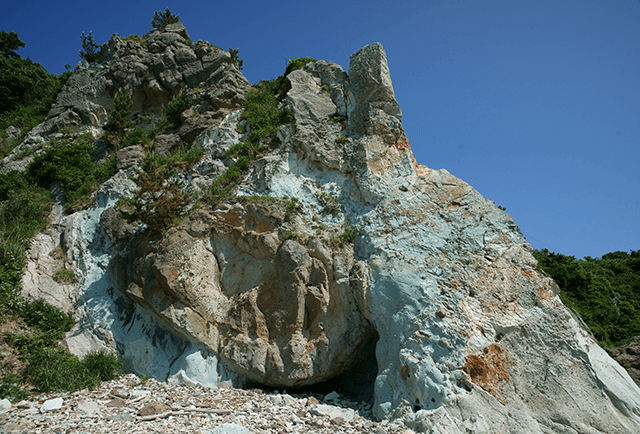
The green tuff here turns an even deeper green when wet. Like the nearby Tsubaki no Shiraiwa Rocks, it is a type of volcanic rock called lapilli tuff formed by volcanic activity about 21 million years ago, but it turned green due to influences such as warm water. The term “green tuff” is said to have originated here at Cape Tateyamazaki. At the time, volcanic matter was often greenish, and it spread throughout the coastal regions of Japan. You can also see the nearby Rousoku (Candle) Rocks (designated as One hundred strange stones from Japan and once called Kannon Rocks due to its shape), Oni no Ashiato (Ogre’s Footprint) Rocks, and Bego Rocks.
-
title Rousoku (Candle) Rocks one word explanation Before it was known as “Kannon”, now it’s known as “candle” keywords geologynaturehistory confirm, register Oga Quasi-National Park, One hundred strange sotones from Japan conservation laws and ordinances Natural Parks Act 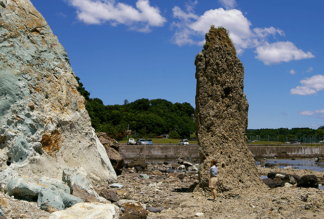
Just to the east of the cliff where you can see the green tuff is a whitish pillar called Rousoku (Candle) Rocks. This rock formation was once called Kannon Rocks. Up until about 50 years ago, there was a head-shaped rock on top of the pillar, but when the “head” toppled due to wind and rain, people began to call it Candle Rocks due to its new shape. The surface is rough due to the small stones embedded in the rock.
-
title Bego Rocks one word explanation What do you resemble? keywords geologynaturesearch confirm, register Oga Quasi-National Park conservation laws and ordinances Natural Parks Act 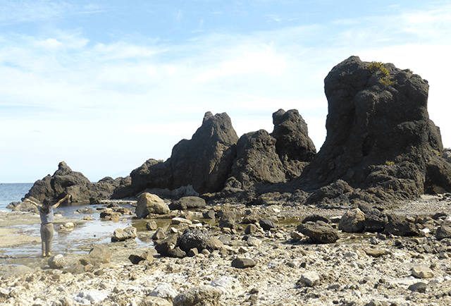
Near the cliff where you can see the green tuff is a rock formation in the shape of a cow called Bego Rocks. This volcanic rock was sculpted by nature through many years of wind and rain erosion. There are many other oddly shaped rocks on Oga Peninsula, so you may make some surprising discoveries when you go rock viewing.
-
title Oni no Ashiato (Ogre’s Footprint ) Rocks one word explanation Left by ogres? Hiding spot keywords geologylegendhistory confirm, register Oga Quasi-National Park conservation laws and ordinances Natural Parks Act 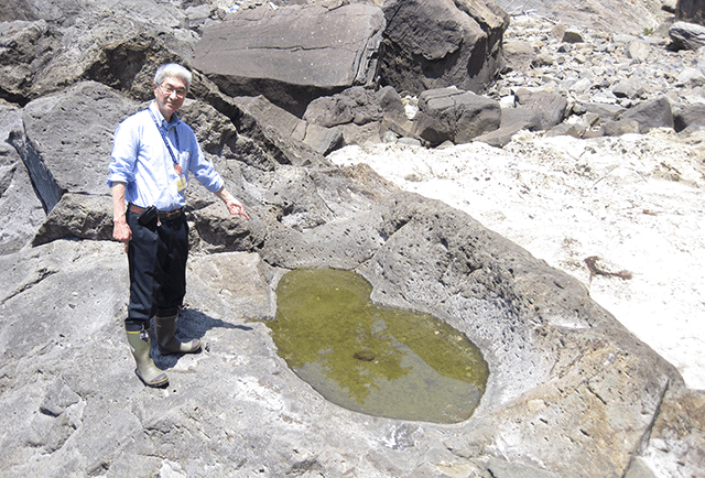
All over Oga Peninsula are mysterious natural phenomena that are beyond the work of man, resulting in legends attributing them to the work of ogres. As its name suggests, Oni no Ashiato (Ogre’s Footprint) Rocks at Cape Tateyamazaki is so named because it looks like the footprint of a giant ogre. There are many other geospots with “Oni (ogre)” in the name, so you may enjoy a trip to visit all the legendary ogre spots.
-
title Gozenotoshi Quay-Sugorokudate Castle Site- one word explanation The legend of Gozen who jumped from the cliff remains keywords geologyhistorylegend confirm, register Buried Cultural Properties (site), Oga Quasi-National Park conservation laws and ordinances Act on Protection of Cultural Properties、Natural Parks Act 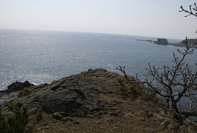
Gozenotoshi Quay lies through a tunnel at the tip of the promontory. A coastal terrace 40m tall and 400m long, this promontory contains the Sugorokudate ruins dating from the middle ages. The lord of the manor was Senjumaru Abe, part of the Ando clan who ruled the Oga Peninsula during the Warring States period, and it is said that his wife threw herself from the cliff after he was defeated in battle. The name “Gozenotoshi” means “falling noble”.
Cape Tateyamazaki
Home >
What is the Oga Peninsula - Ogata Geopark? >
Geosites and spots >
south coast area >
Cape Tateyamazaki